Matthew Zimmerman, CEO, FarSounder discusses enabling safe exploration with underwater perception.
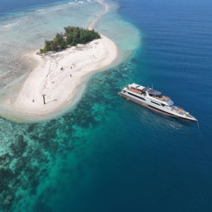
Guest and owner motivations are changing the destinations they seek and the itineraries they plan. The desire for unspoiled destinations free from mass tourism, coupled with a growing pursuit of purpose and authentic experiences, is shifting yachts away from crowded traditional hubs toward remote, private and experiential destinations. This trend presents a challenge for bridge crews and management teams: how to deliver privacy and exclusivity safely. A vessel can quickly find itself in uncharted or poorly charted waters, often far from immediate shoreside support should an accidental grounding or collision occur.Every captain has a story about a time they, or someone they know, ran aground while trying to meet guests’ expectations: finding the perfect sunset anchorage, reaching an ideal reef for snorkeling, or exploring a hidden inlet. The pressure to prioritise privacy and avoid crowded destinations can lead to pressure to make a passage with limited situational awareness of the navigation picture ahead.
This is where technology can play a critical role, helping unlock safer access to remote destinations while enabling captains to deliver the experiences guests expect.Many people assume ECDIS and the growing array of unofficial electronic chart data can provide the technological answer for navigating these environments. However, according to Seabed 2030, only 28.7% of the world’s oceans have ever been mapped, as compiled by GEBCO, an organisation founded by Prince Albert I of Monaco more than 120 years ago. Much of this mapping is at resolutions below those required for safe navigation. In coastal areas where yachts spend much of their time, only about half of the shallower waters have been surveyed to modern standards, and most of those surveys are concentrated in primary shipping lanes rather than the pristine locations guests envision.When reviewing both official and unofficial best-available charts in remote locations, depth soundings are often few and far between, sometimes originating from historical surveys dating back to Captain Cook.
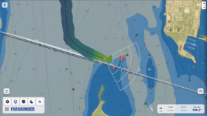 Chart reliability may be labeled CATZOC-U, indicating that position accuracy, depth accuracy, and seafloor coverage are unknown.In practice, actual depths may differ significantly from charted depths and uncharted hazards may exist. In some cases, obstacles such as sea mounds, shoals and submerged atolls may have been accurately measured in depth but have charted positions that are off by hundreds of metres. In today’s age of GNSS and digital charts, these apparently detailed surveys can create a false sense of security. A vessel may believe it is confidently navigating around a known obstacle when, in reality, it could be steaming directly toward a hazard whose charted position is inaccurate. To navigate safely, a vessel needs comprehensive situational awareness both above and below the water. Yet none of the mandated navigation equipment onboard a yacht provides underwater perception ahead of the vessel. The required underwater sensor, an echosounder, measures water depth directly below the vessel but does not warn the crew about an underwater obstacle ahead.
Most yachts are equipped with above-water camera systems, which provide valuable situational awareness. However, cameras cannot see through the water and therefore cannot identify submerged hazards. Real-time underwater perception can provide an important additional layer of safety in these challenging environments. One option is to launch a small, shallow-draft tender ahead of the mothership to map a potential route. While relatively straightforward, this approach carries significant operational costs and limitations, including tender availability, maintenance, crew availability and suitable weather windows for launch and recovery. There is also the risk of running the tender aground on rocks, coral or other hazards just below the surface.A more effective solution is 3D Forward Looking Sonar installed on the mothership. The most capable systems can map the seafloor in three dimensions ahead of the vessel with a single ping to at least eight water depths, while detecting in-water hazards such as rocks, ice, coral, whales and containers throughout the sonar’s range.In a recent survey distributed through YATCO/ACREW, 85% of respondents said they considered 3D forward-looking sonar at least moderately necessary. Two-thirds said they would recommend the technology for a future vessel or refit, while more than half reported that sonar had helped them avoid a grounding, collision or near-miss.
 FarSounder has produced navigation sonars for more than 20 years, with its Argos 3D Forward Looking Sonars installed on yachts ranging from 17m – 175, as well as on cruise ships, naval vessels, USVs and other platforms. Argos provides a picture of the environment ahead of the vessel out to a 1,000m range while simultaneously building a map of the seafloor wherever the vessel travels. Users can opt in to anonymously share their mapping data across the fleet. In return, they receive access to aggregate mapping from other participating vessels, while FarSounder contributes depth measurements to Seabed 2030 on their behalf.The value of underwater perception is driven not only by detection capability, but also by how effectively it integrates into the yacht’s overall situational awareness. FarSounder’s latest software, SonaSoft LT, is designed to give bridge crews a simple, intuitive picture of the vessel’s navigational situation. The system fuses 3D Forward Looking Sonar and Local History Map data with above-water sensors, including camera feeds, SEA.AI detected objects, Tocaro Blue’s AI-processed radar targets, AIS, and ARPA. These feeds are displayed over nautical charts and aerial imagery, combining multiple navigation inputs into a unified display that can run on a bridge computer, laptop or iPad. Another benefit of FarSounder’s technology is its potential to help reduce whale ship strikes. Argos can detect whales and provide another layer of awareness to help mitigate the risk of collision. The sonar is designed to be safe for whales and can form part of a broader whale-detection solution when used alongside above-water camera systems.Whether incorporated into a new build or a refit, Argos 3D Forward Looking Sonar provides underwater perception that can increase navigation safety and make the bridge crew’s job easier. The technology is available globally and has been proven on superyachts for more than two decades.